Photogrammetry for Everyone
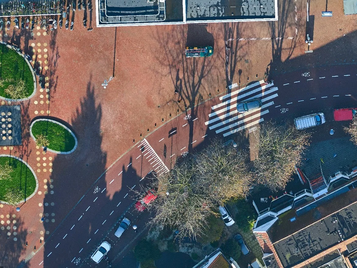
EyeBase is the fastest stereographic mapping system, developed by Geodelta and specifically optimized for managing municipal topographic registrations such as the BGT and BAG in The Netherlands. With its user-friendly, intuitive interface, EyeBase is designed to make accurate mapping from aerial photographs accessible to everyone. The system requires only a stereo display and no expensive additional hardware like a specialized measuring mouse. This makes EyeBase ideal for municipalities, water boards, and engineering firms focused on keeping topographic registrations up to date.
Efficient Maintenance of Topographic Registrations
In many jurisdictions, municipalities are legally required to keep topographic registrations up-to-date. Stereoscopic mapping from aerial photographs offers the most efficient solution for this. With EyeBase, you can perform maintenance at a high-quality level without compromising on speed and efficiency.
Seamless Integration with Your Existing Software
EyeBase is designed to excel in rapid mapping from aerial photographs. For maintaining your topographic registration, you likely already use other software. Therefore, EyeBase integrates seamlessly with your existing systems. We continuously work on new integrations, so let us know if your current software environment is not yet connected to EyeBase.


Unique Functionality
EyeBase offers a range of powerful features for efficient and accurate mapping:
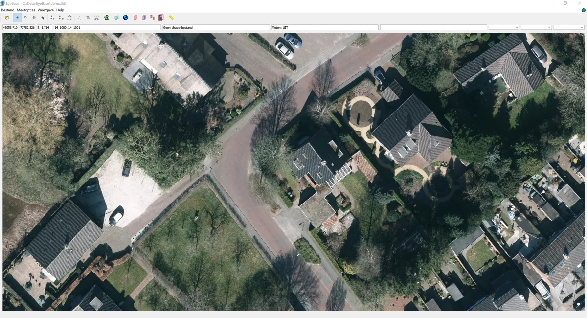
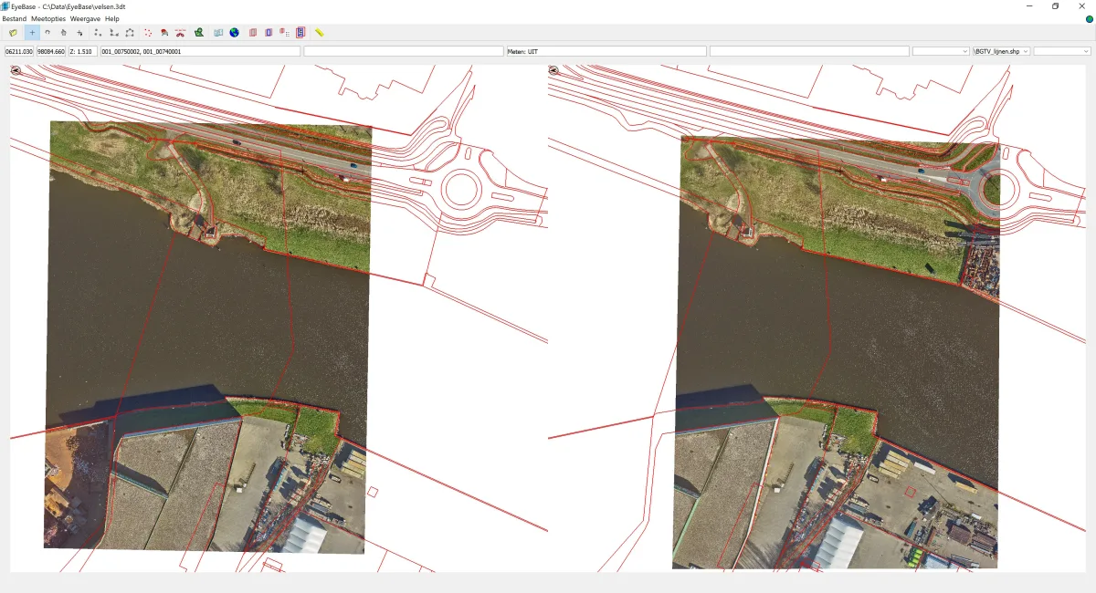
- Direct Stereo Display: Visualize aerial photographs with a one-time conversion to the stereo image format based on triangulation and bundle block adjustment results.
- Integration with existing data: Combine topographic data with stereo images, allowing you to map changes three-dimensionally and make them immediately visible in the model.
- Attribute Data Entry: Easily add attributes to objects during mapping to build a complete data model.
- Search based on coordinates and addresses: Quickly and easily open coordinates and address locations in the stereo model.
- Export to Anaglyph Images: Export stereo images as red-green or red-cyan images for use in reports.
- Access to Additional Sources: Through EyeBase, visualize panorama and oblique photos directly from StreetSmart by Cyclomedia or from Slagboom en Peeters.
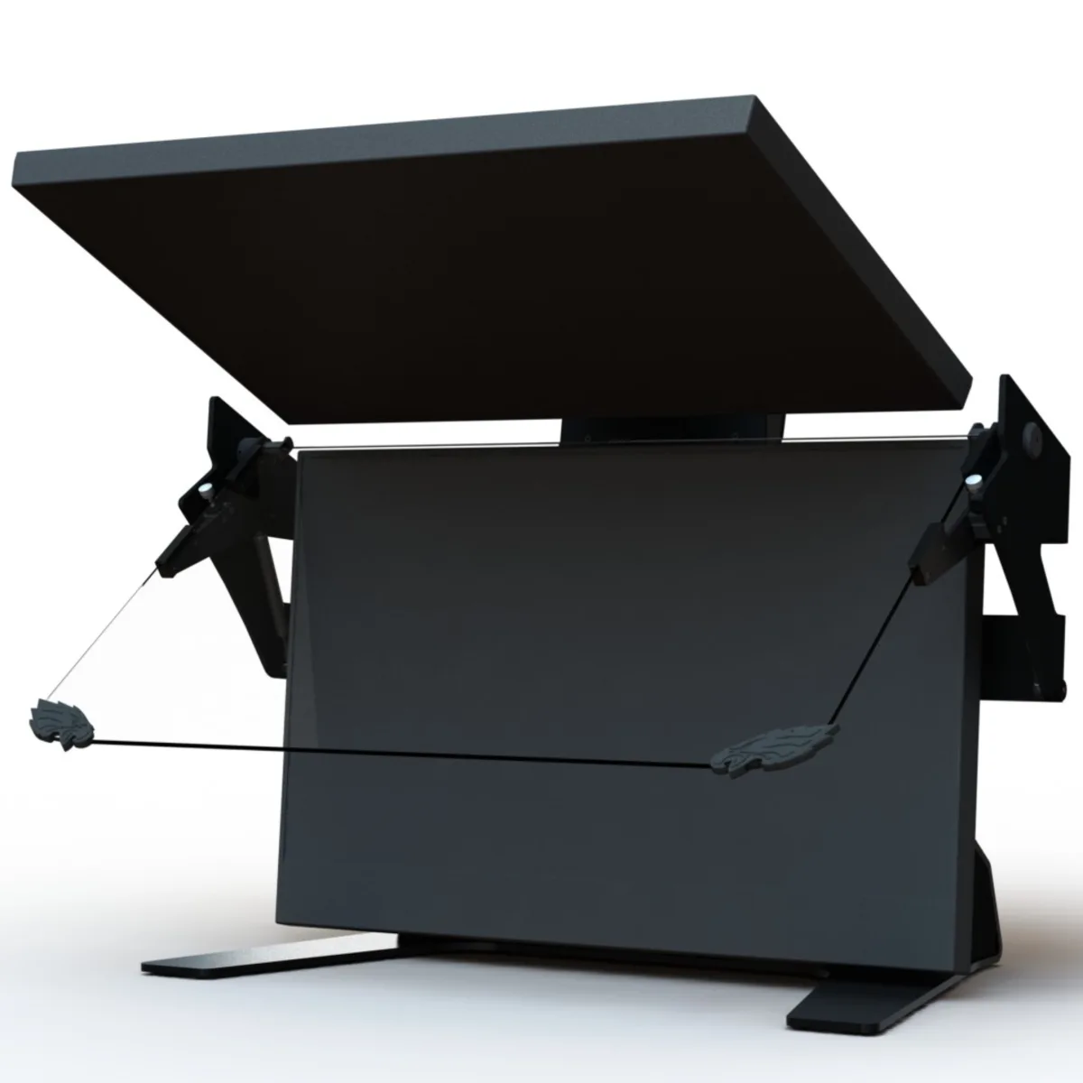
Hardware for Stereo Display
EyeBase is designed for use with a stereo display and does not require expensive additional equipment. Geodelta is the exclusive supplier of stereo screens from VRLOGIC and Schneider Digital, two reliable German manufacturers of stereo displays. Additionally, Geodelta provides all necessary peripherals and on-site installation.
As experts in stereo display, we can also assist with the maintenance and proper adjustment of existing stereo screens.
Visit our webshop for more information about our hardware products.
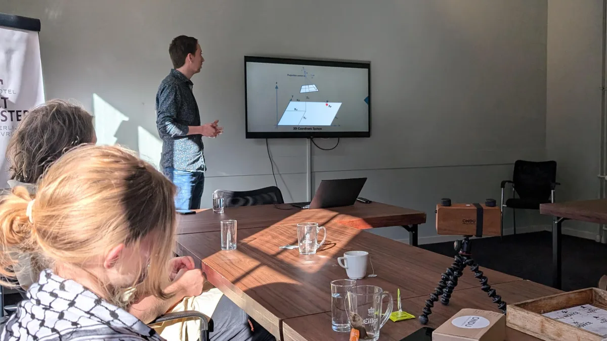
Training
After installation, Geodelta offers a one-day training that explains the basics of photogrammetry and the use of EyeBase. For users new to stereoscopic mapping, we recommend scheduling an additional training day a few weeks after the first session. This follow-up day helps users further reinforce and optimize the knowledge gained.
Start Using EyeBase
EyeBase is the choice of leading engineering firms, municipalities, and government agencies in the Netherlands for maintaining topographic registrations. Ready to experience EyeBase for yourself? Contact us for a demonstration and discover how EyeBase can help your organization perform mapping tasks quickly and accurately.