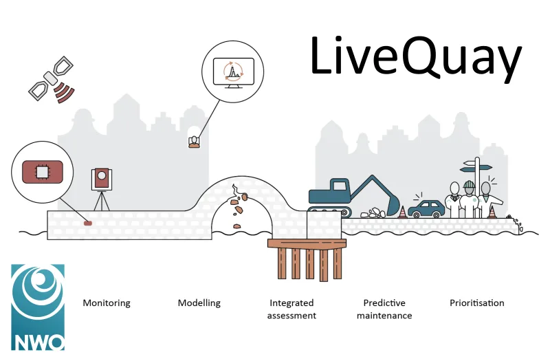
Applied Research: Geodesy as a Solution
Our team of specialists possesses in-depth knowledge in areas such as laser scanning, photogrammetry, deformation analysis, reference systems, map projections, and base registrations. By utilizing principles like the Delft Method for Adjustment and Testing, we deliver solutions that enhance both our internal processes and those of our clients.
Diverse Projects
Examples of our research projects include:
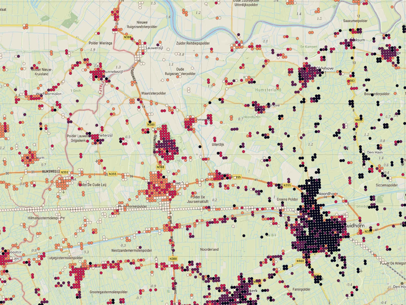
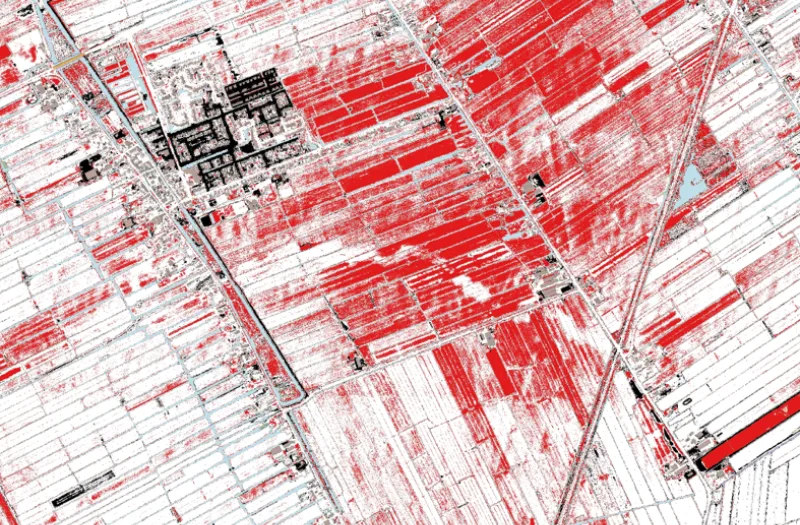
- Measuring and analyzing ground movements in the Netherlands.
- Investigating the quality of base registrations.
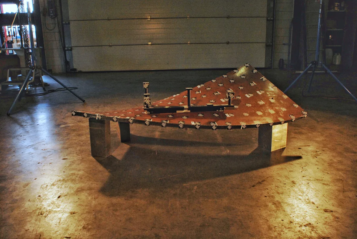
- Applying photogrammetry for precision applications.
Our expertise extends beyond geodesy. We regularly apply our methods in other sectors, especially where error checking is crucial. This makes our approach versatile and effective across various contexts.
Software Development: Tailored to Your Processes
Geodelta serves many clients as a remote software development department. Our software engineers distinguish themselves through their substantive knowledge of geodesy and geo-information, enabling them to understand our clients' challenges better than regular IT service providers. We assist with:
- Accelerating existing workflows.
- Automating manual tasks.
- Developing specific control software to reduce failure costs.
Collaboration with Knowledge Institutions
Geodelta maintains close ties with universities both domestically and internationally, particularly with Delft University of Technology. We collaborate in research programs, deliver lectures on photogrammetry, laser scanning, and geodesy, and offer internship and graduation opportunities. Educating the next generation of geodesists is a core value for Geodelta.
Our Current Work
Solutions that work
Is your organization facing complex geo-information challenges? The experts at Geodelta can swiftly and effectively guide you to a solution. Contact us to discover how we can support you with our knowledge and innovations.