
Effortless Maintenance of Topographic Registrations
For municipalities, provinces, water boards, and other custodians of topographic data, up-to-date geo-information is essential. While traditional land surveying and stereo photos remain common, many additional data sources are now available: point clouds, panoramic images, oblique images, 3D Tiles, and more. Omnibase integrates all these data sources, making them directly and easily accessible for efficient use in all topographic registrations.
All Imagery and 3D Data at Your Fingertips
From Omnibase, all types of imagery and 3D data are readily available.
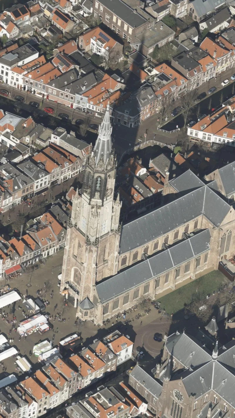
Oblique photos

Panoramic images
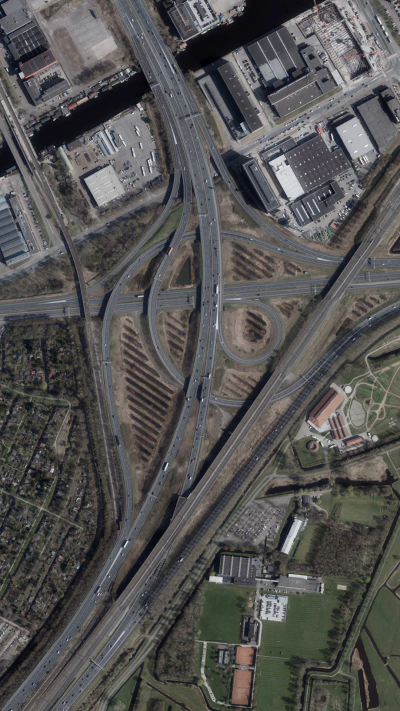
Nadir photos
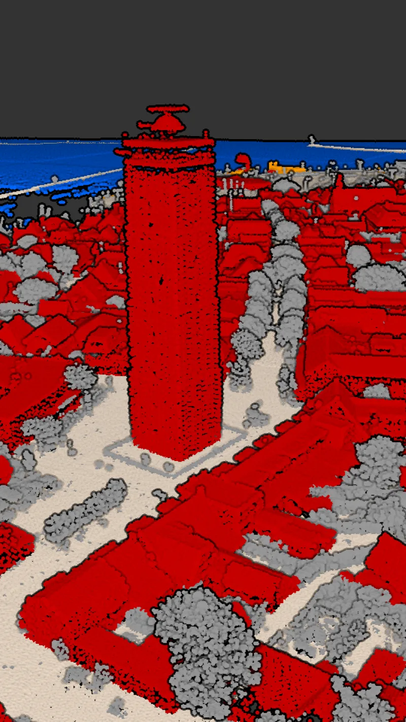
Point clouds
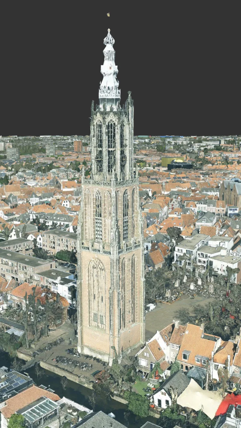
3D meshes
Starting Point for Drone Data
Omnibase acts as the link between self-collected drone data and everyday workflows, such as managing large-scale topography. Effortlessly add drone photos and point clouds to Omnibase and leverage Geodelta's photogrammetry expertise for reliable measurements in both photos and point clouds.
Because Quality Matters
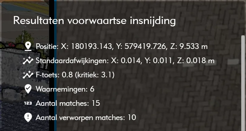
Developed by geodesists, Omnibase is designed for administrators of topographic registration who demand high-quality data. Your registration must meet legal standards while ensuring the collected geometry is widely applicable. Omnibase ensures measurements comply with standards and best practices from the fields of lad surveying, photogrammetry and laser scanning. For photogrammetric measurements, you can review adjustment results before approval. The acquisition method and achieved precision are added as metadata to the coordinates if supported by your data management software.
Omnibase also enables basic quality checks, such as comparing datasets to national elevation datasets.
Seamless Integration with Topographic Data Management Software
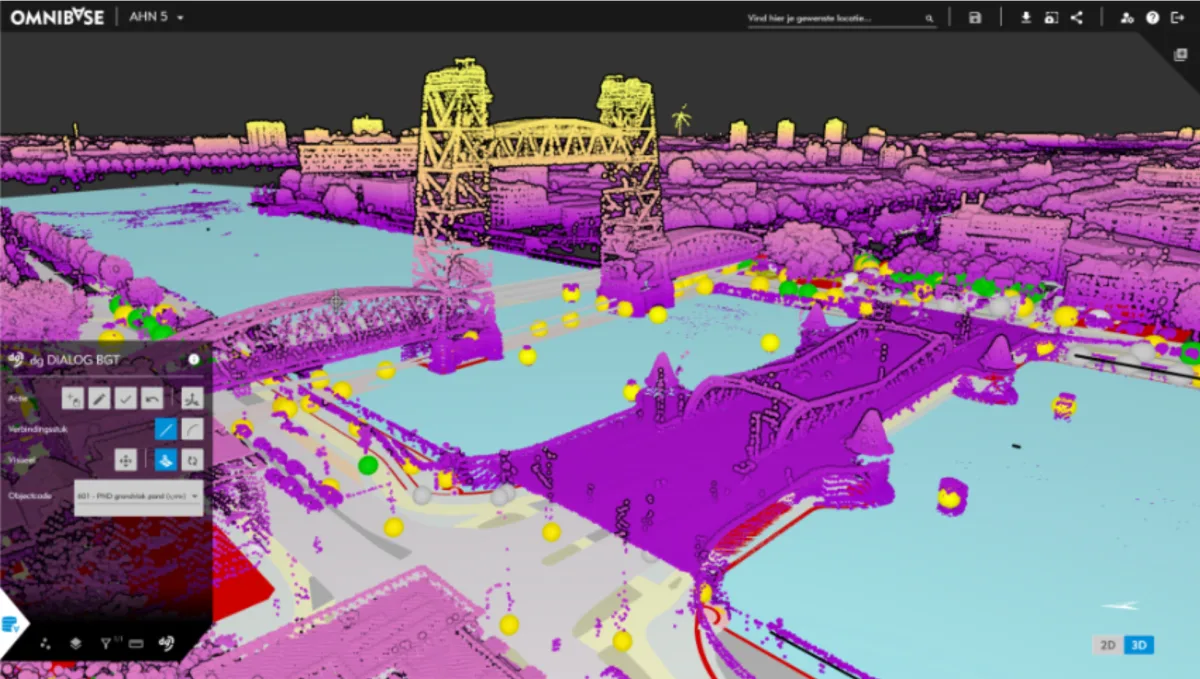
For clients in the Netherlands, Omnibase integrates smoothly with various management environments of the Base registration of large scale topography (BGT). Measurements are instantly visible in the familiar interface, enabling rapid acquisition of new geometries. Additionally, relevant data sources like panoramic images, oblique photos, and point clouds are accessible at any time. For software without integration capabilities, Omnibase offers simple import and export options.
The AHN Always at Hand
The Dutch National Elevation Dataset (AHN) provides nationwide height data acquired through Airborne Laser Scanning. The resulting point cloud is vast, but Omnibase is one of the few applications that can effortlessly and quickly visualize this data. With constant access to AHN4 and AHN5, users can rely on accurate 3D information. To further enhance usability, Geodelta has added color information to the AHN. Other nation wide datasets can be added as standard base layers in Omnibase as well.
Measurements without borders
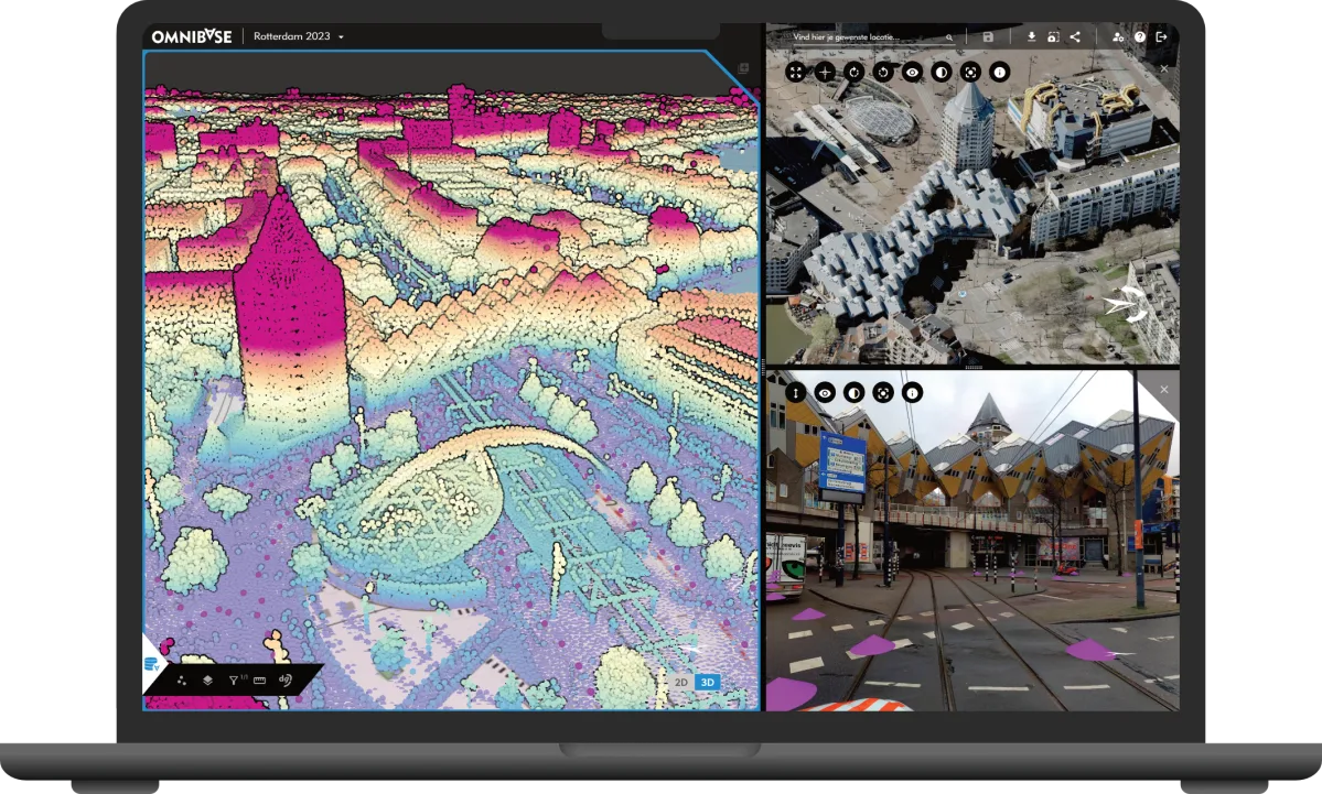
Each dataset has its advantages. In Omnibase, you don’t need to choose between oblique photos, nadir photos, panoramic images, or point clouds. Combine all datasets within a single measurement. Start in a point cloud and finish your measurement in a panoramic image. With advanced measuring tools for oblique photos, you can update changes in no time.
Thanks to the convenient split-screen feature, you always have a comprehensive view of all data sources, allowing you to examine objects from multiple perspectives.
A Selection of Tools
Omnibase offers a wide array of tools for effective geo-data utilization:
- Visualizing point clouds by color, intensity, classification, and height
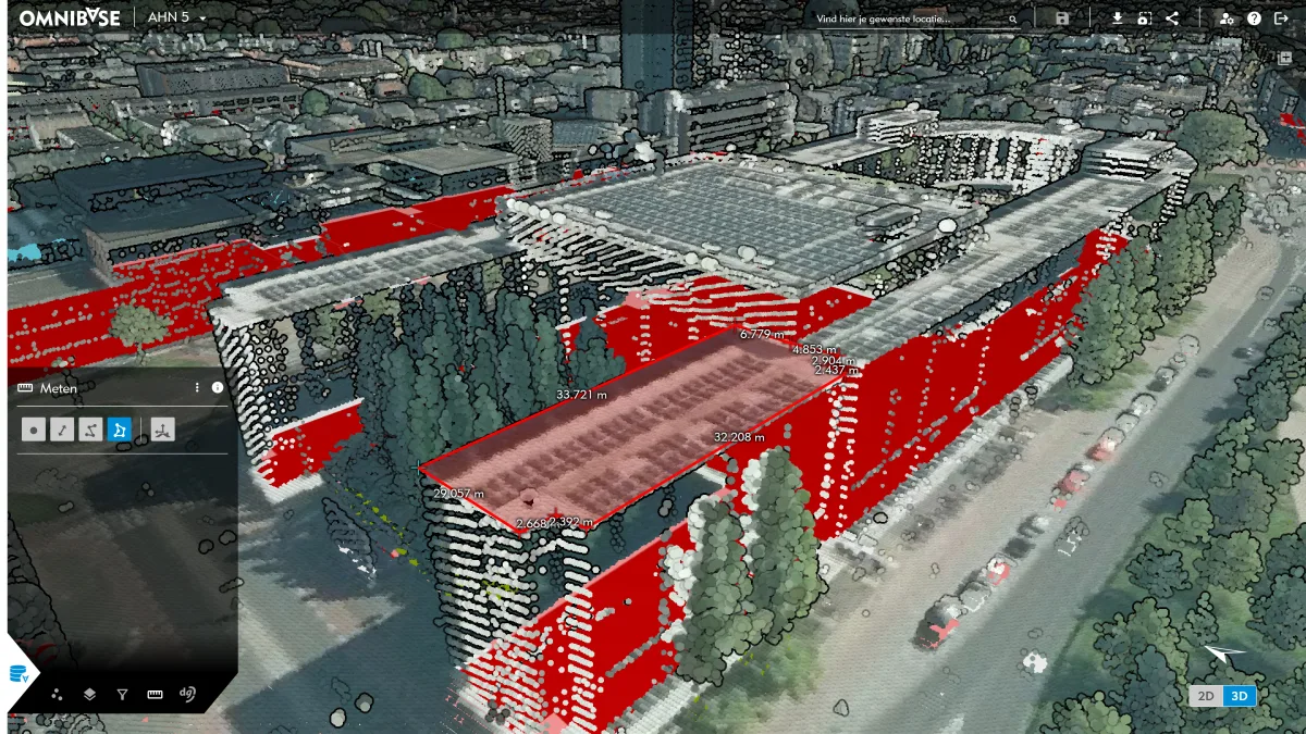
- Measuring from point clouds
- Measuring cross-sections
- Measuring from nadir photos
- Measuring from oblique photos
- Measuring from panoramic images
- Visualizing web services as background layers
- Integration with BGT management software
- Exporting to GIS and CAD formats
- Self-service data upload management
- Secure European cloud environment
Want to Learn More?
Would you like to learn more about Omnibase and how to use it efficiently?