The January update of Omnibase is now available, which means that users have new features and improvements to current features at their disposal within Omnibase.
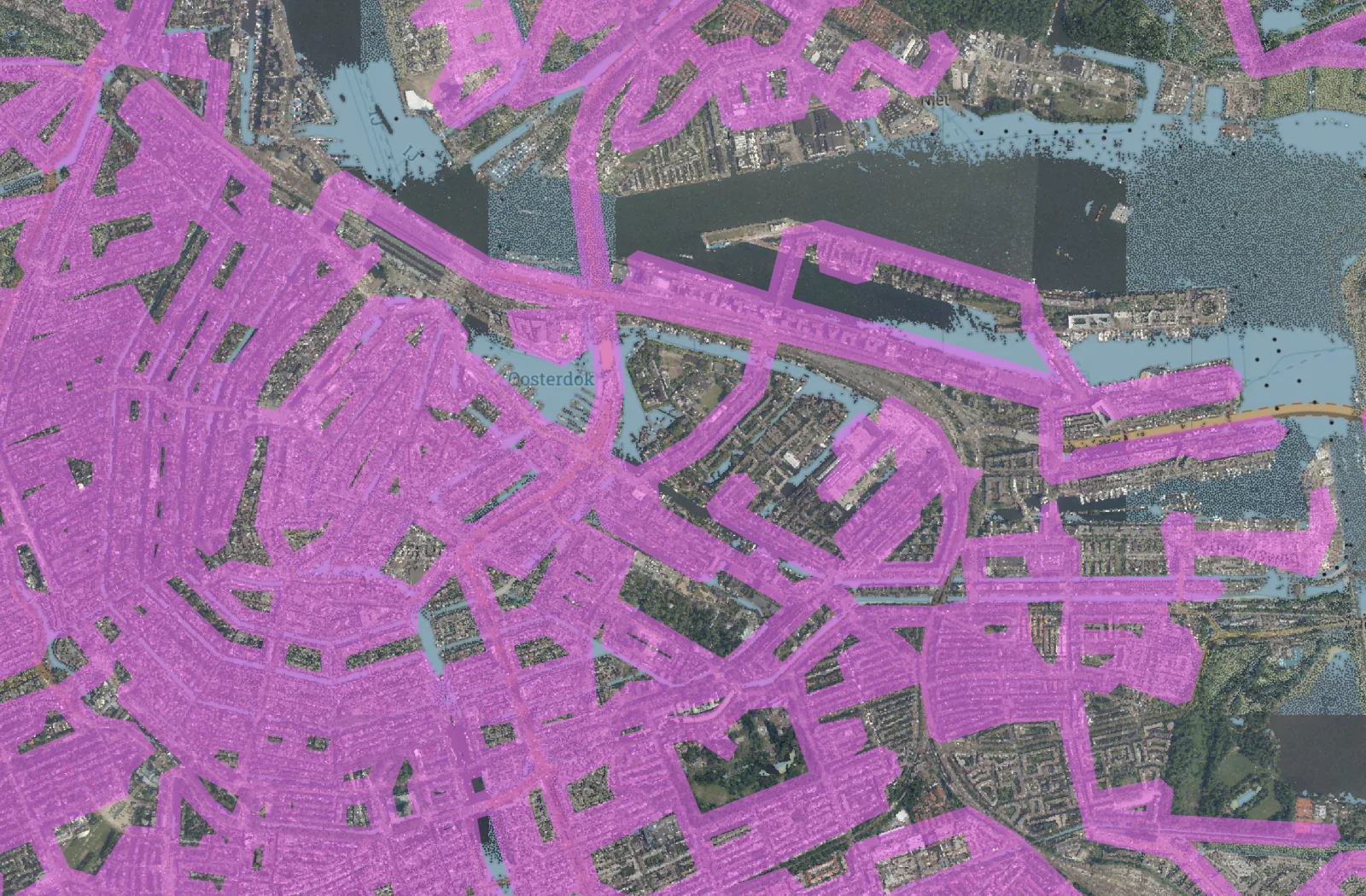
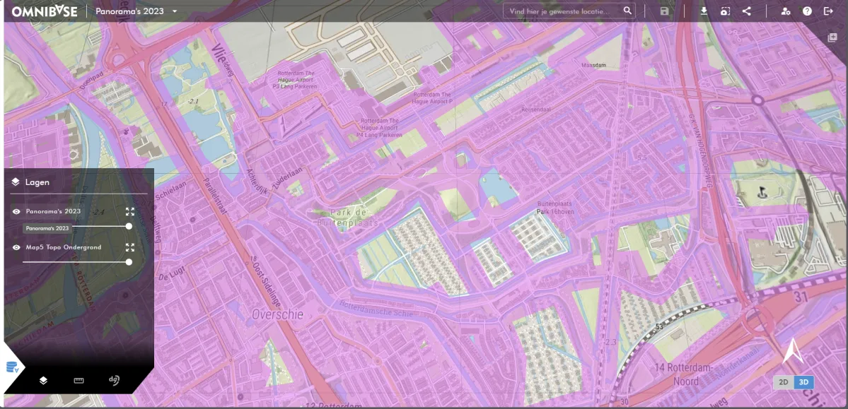
Geodelta is constantly working to improve performance and add new features. From now on, you can easily view the full coverage of any dataset in Omnibase. The combined footprint of this data is automatically calculated when creating a dataset. This coverage works for all data types within Omnibase and looks like this:
In addition to these new features and improvements, several bug fixes, performance improvements and other updates have been made. What's New:
- Improvements to the upload and publish process, allowing a user to upload and make available large-scale datasets clearly, quickly and efficiently.
- Prevention of inadvertent road-navigating when managing data sources, datasets and projects.
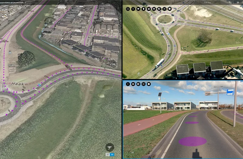
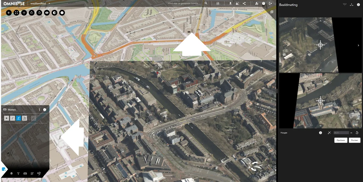
- The auxiliary images of aerial and panoramic photos used for a photo measurement now remain open within the dg DIALOG BGT menu for performing multiple measurements of the same object.
- Adjustment determination side images in panorama measurement, allowing to perform a measurement with auxiliary images dynamically selected at optimal angle and distance.
Adjustments we are working on now for new Releases
Below are the new developments we are currently working on. These are both developments that enhance existing functionality and new future functionality that will become available. The following developments are currently being worked on:
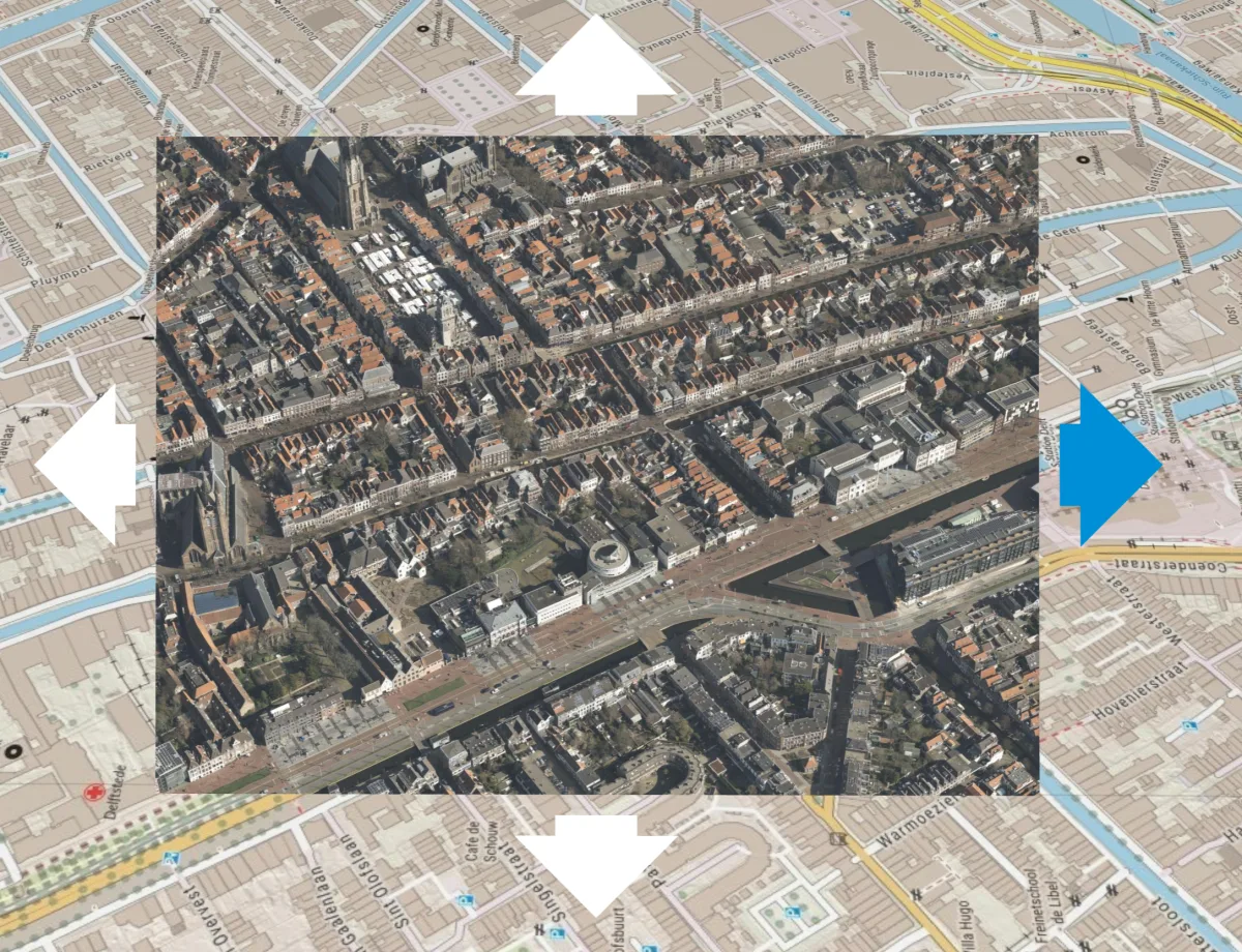
Improving navigation (aerial) photos.
Although the functionality of Omnibase works efficiently for opening a new photo, it can sometimes be the case that an object is just a little better visible in a next or previous photo. To navigate this easily and quickly, we are now working on functionality to open an adjacent photo based on arrows in the viewer as well as on arrow keys. Below is an example of what this will roughly look like:
During measurement in an aerial image, the auxiliary images can also be changed as shown below:
Insight into data storage
Understanding data storage is essential for a transparent and clear overview of your data in Omnibase. We are working on functionality to enable administrators of an organization to see how much data is stored within your data bundle and how much space is left for new datasets. It will also make visible which types of data sources are present and how much space they take up per data type.
Would you like to know more about all the other features of Omnibase? Then please contact us.
Wilt u meer weten over alle andere functionaliteiten van Omnibase? Neem dan contact met ons op.