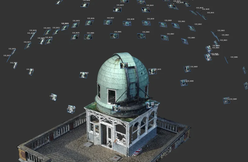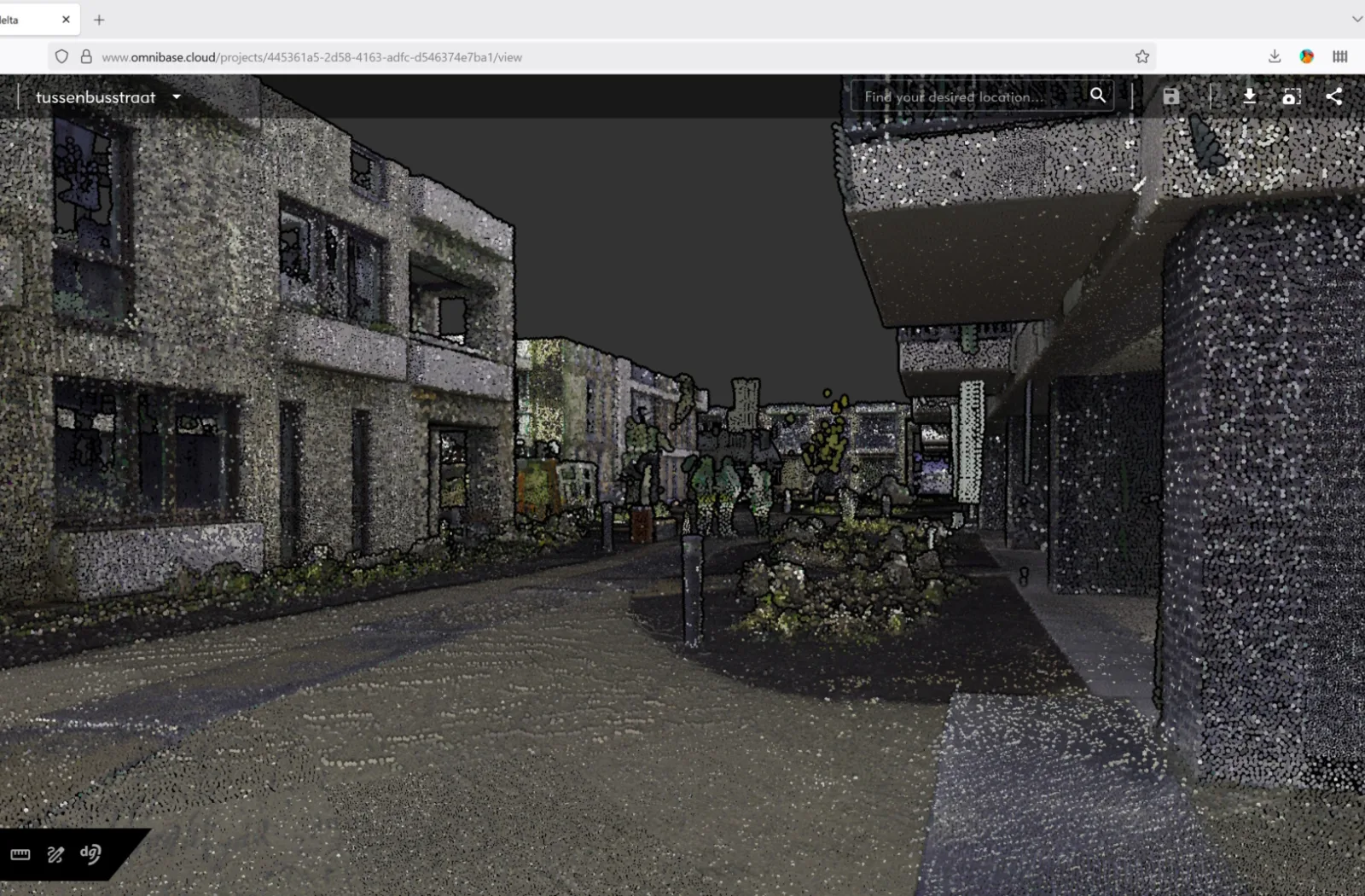
On Monday, September 8, 2025, Geodelta is performing an update to Omnibase. This update again brings a lot of new functionality to the online 3D platform.
Modifying measurements and annotations: snapping
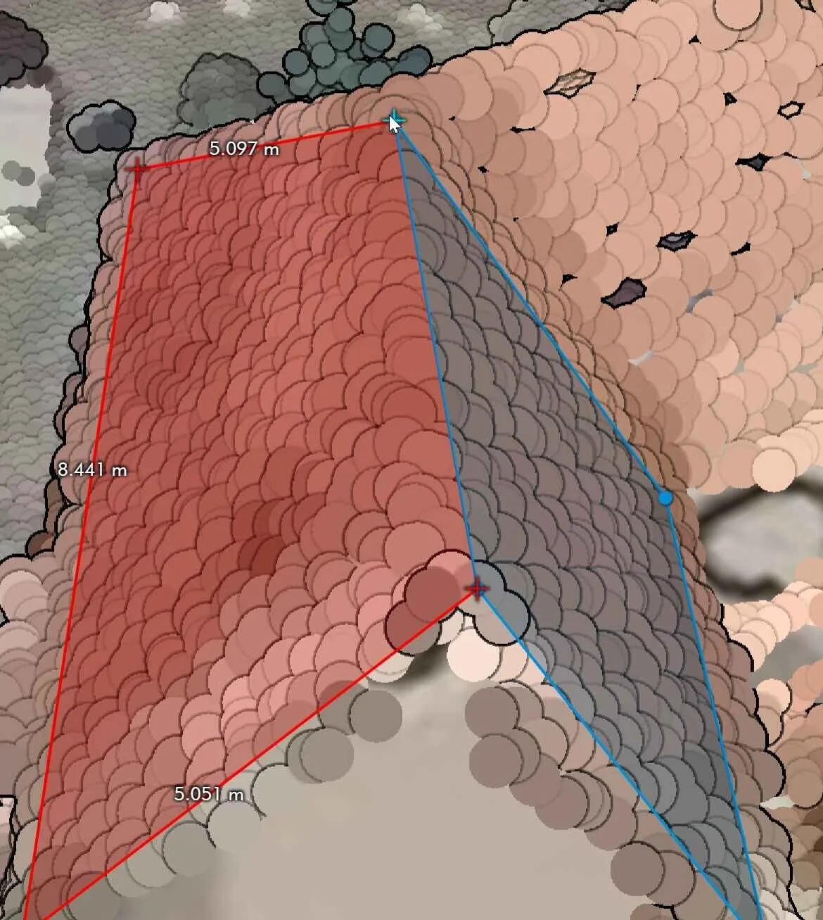
From now on, it is possible to snap the geometry of measurements and annotations to other measurements and annotations, with which both nodes are at exactly the same coordinate. This can be done while creating a new measurement or annotation or while modifying a measurement or annotation.
How does it work for a new measurement?
Start a new measurement and perform the measurement. Where to connect to a node of an already existing measurement or annotation: keep the mouse on the other node. When it turns blue instead of red (see below), the new measurement point is snapped to the existing measurement point with which both nodes are exactly at the same location.

How does it work when editing a measurement?
- Activate edit mode
Right-click on the desired object and choose the option to change the geometry
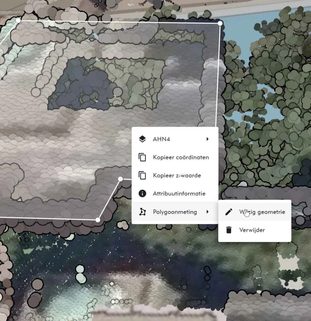
- Editing nodes
Geometry nodes are represented as yellow squares.
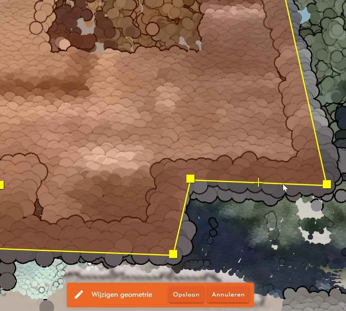
Now 3 actions can be performed:
- Move: click on a yellow square and drag it to the desired position and snap on an existing measurement point. Note that the measurement point turns blue if the measurement is within the snapping tolerance.
- Remove: right-click on a node and choose 'remove node'.
- Add: move the mouse to the center of a line segment - a yellow cross will appear which you can click on to add a new node.
Save changes
When you're done, press the space bar or click the Save button at the bottom of the screen to save the changes.
Opening Omnibase from the URL
It is now possible to open Omnibase with a default URL per project from the browser. This also makes it possible to open Omnibase directly from another application, when it supports opening a web browser based on URL including parameters. Thus, the following parameters can be set (parameters both uppercase and lowercase):
- Open Omnibase directly in an XY location
- Open Omnibase directly in 2D or 3D mode
- Open directly an aerial photo or panoramic photo, which is rotated directly to the XY coordinate in split-screen mode
- Directly opening a particular view direction of an oblique photo
The URL should be constructed as follows. Open a project, copy the full URL and add a '?' at the end. Then add one or more of the options below as URL parameters. For example:
https://www.omnibase.cloud/projects/{project-uuid}/view?modus=2d&x=85058.045&y=447164.847
All parameters to be set are as follows:
URL Query parameter open viewer at XY location:
- Open Omnibase directly at an XY location.
- <project-url>?x=85057.604&y=447166.311
URL Query parameters included for 3d/2d mode:
- Open Omnibase directly in 2D or 3D mode.
- <project-url>?mode=2d, or
- <project-url>?mode=3d
URL directly opening data source in split screen:
- Directly open an aerial or panoramic photo (dataset name must contain this name), e.g:
- <project-url>?dataset=oblique, or
- <project-url>?dataset=panorama
URL pass along direction of opened photo:
- Directly open a particular viewing direction of an oblique photo
- <project-url>?x=85057.604&y=447166.311&dataset=obliek&richting=n, of
- <project-url>?x=85057.604&y=447166.311&dataset=obliek&richting=o, of
- <project-url>?x=85057.604&y=447166.311&dataset=obliek&richting=z, of
- <project-url>?x=85057.604&y=447166.311&dataset=obliek&richting=w
Save view vector to annotations
When an annotation is saved, the view direction of the current view is now saved. This allows better zooming to an annotation location when zooming to it from the annotation menu.
Projects in draft mode
A new project can now first be created in draft mode as long as the data is still being uploaded or the project is not yet ready to publish to other users within the organization.
A draft project is only visible to the user who created the project or the admin of the organization, they can also make the project available to other users within the organization by unchecking the draft checkbox.
This setting is useful if the correct camera settings have yet to be assigned to a set of aerial images or the data is not yet 100% converted and present.
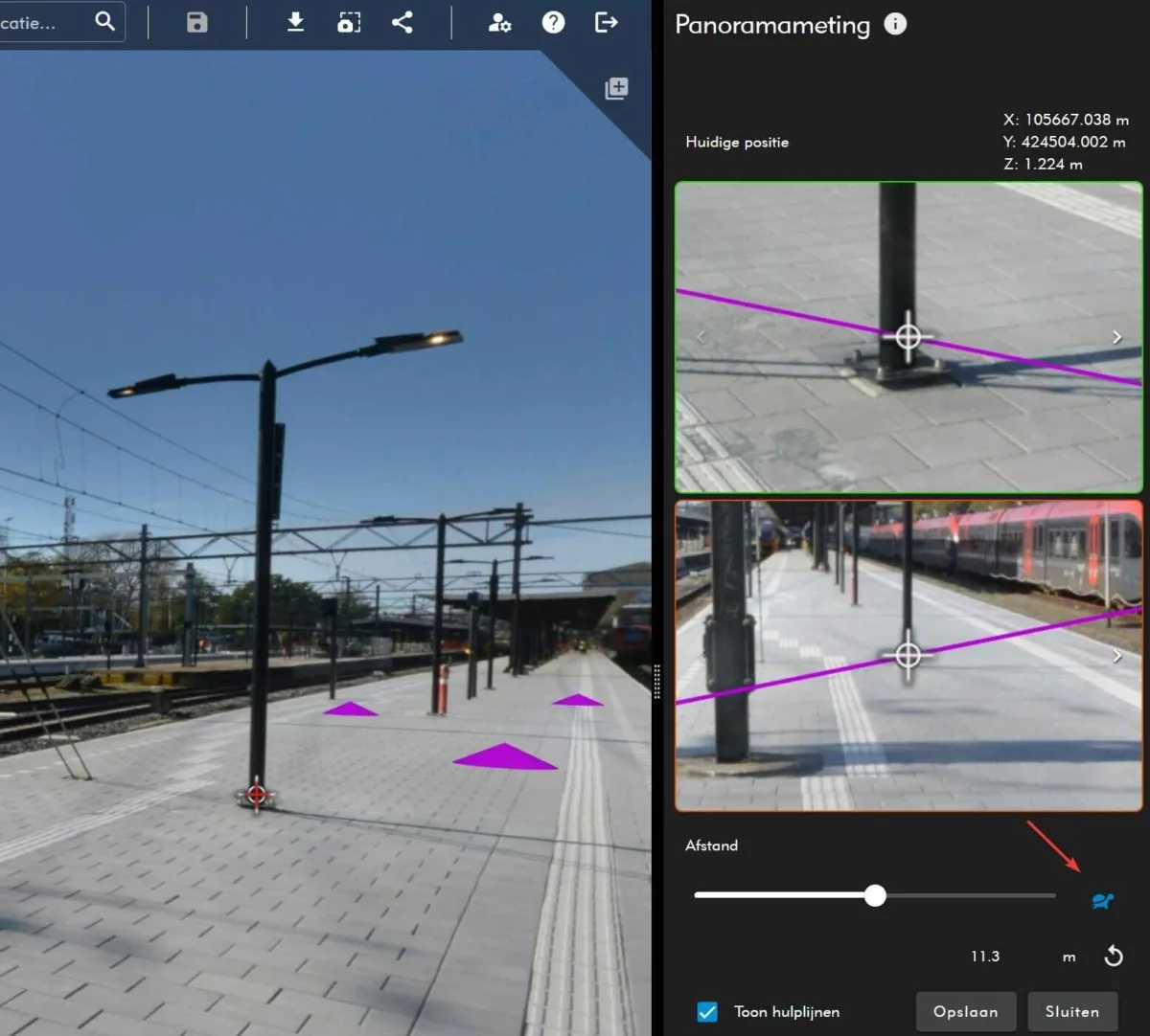
Fine panorama slider
The panorama slider can now be set with the icon on the right side of the slider to adjust the indentation more precisely.
First, Omnibase tries to make an incision with the point cloud and often the measurement point is already almost right. But sometimes a piece of the point cloud is missing and the measurement point has to be adjusted with the slider.
By placing the measuring point approximately correctly and activating the slow slider mode (note that the icon turns blue), a user can adjust the measuring point very accurately and with precision using the slider. That the icon turns blue is visible in the example below. Whereas this is sometimes difficult with the faster slider adjustment mode, it can now be done very easily and quickly with the slower mode.
This now works exactly the same as the shortcut keys and these can still be used as well:
- Alt + Scroll: Changes the distance slider
- Alt + Shift + Scroll: Changes the distance slider with more precision
When the second option is used, the icon is also displayed in blue and the slider moves with more precision.
Various bug fixes, performance improvements and other updates
In addition to this extensive list of new features and improvements, several bug fixes, performance improvements and other updates have been made:
Improvement in loading panoramic photos: all available panoramic photos (purple spheres) are now visually loaded only after the user has zoomed in on a location.
- Touch support (beta support) has been added within Omnibase.
- Annotations are now loaded faster and more efficiently when opening a project.
- When aerial photos have little to no overlap in the cross-direction (especially older datasets), subsequent photos in one direction are now retrieved with a larger buffer. The cross-section tool now also remains open while performing a measurement in Omnibase and no longer closes after accepting each measurement point.
- The point cloud transparency sliders move together again.
Did you know...
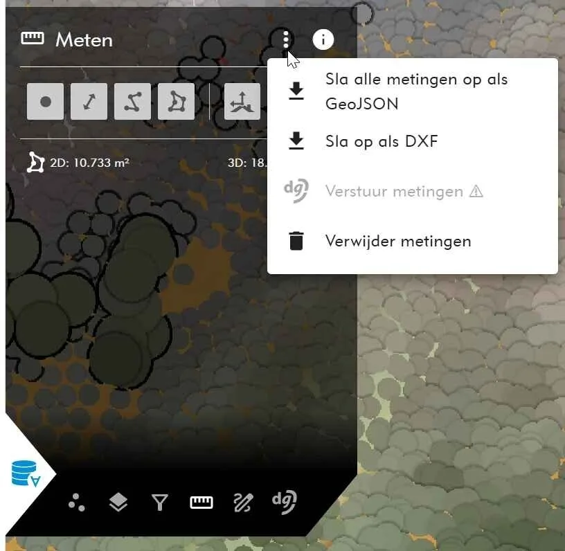
...it is possible to export measurements from Omnibase to GeoJSON and DXF?
After creating measurements in a project (which are stored locally in your browser), you can export to GeoJSON or DXF via the more-options menu in the measurements menu. For example, you can open measurements in a GIS, CAD or BGT application.
Adjustments we are now working on for new releases
Geodelta is continuously working to improve the performance and extend the functionality of Omnibase. Below are the developments we are currently working on. These include both enhancements to existing functionality and entirely new features coming soon.
We are currently working on the following developments:
- COPC support: Full support for Cloud Optimized Point Clouds (COPC).
- Time Filter: Support to filter by dates of different dates via a time slider. For example, for filtering photos by year.
Wilt u meer weten over alle andere functionaliteiten van Omnibase? Neem dan contact met ons op.