Geodelta verifies Street-LiDAR data for application in municipal processes.
Quality Street-LiDAR mapped
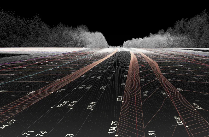
Geodelta was commissioned by the municipality of The Hague to conduct a comprehensive check of the Street-LiDAR point cloud. This project focused on automated testing of the accuracy of this data against base points. This allowed a manual and time-consuming process to be replaced by an efficient and large-scale analysis.
Lidar data versus GNSS points
Geodelta analyzed both the elevation and planimetry of the Street-LiDAR point cloud by comparing it to over 3,000 GNSS points. These points were measured and supplied by the Municipality of The Hague. This comparison was performed fully automatically. Only ground planes with a standard deviation of less than 5 cm were used for the analysis.
Street-LiDAR as part of management process
The Hague municipality sets high quality standards for the geometry that is collected in The Hague for the basic registrations. From the checks followed several recommendations for geometric corrections that could be applied to the data, so that the Street-LiDAR data can be used for these applications.