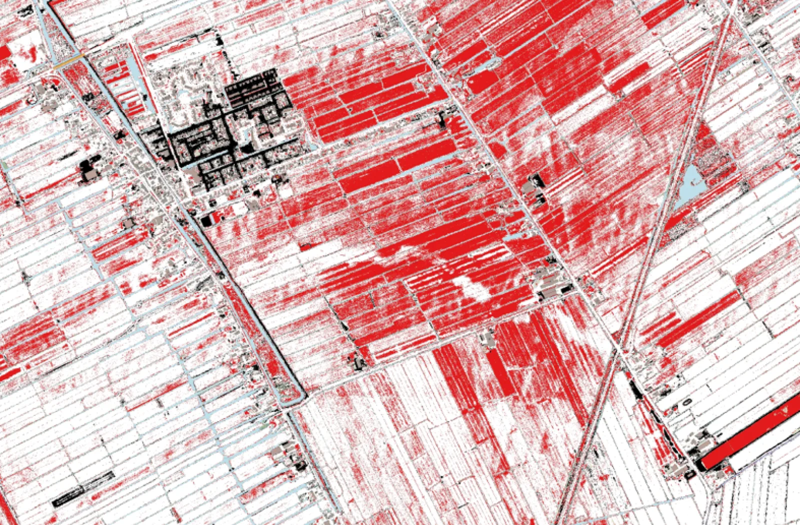
Geodelta has developed a height difference grid by comparing the data sets of AHN3 and AHN4. This grid provides an accurate understanding of shallow ground movements, without being disturbed by measurement errors from the original datasets.
Why a height difference grid?
In simple comparisons between AHN3 and AHN4, measurement errors can lead to differences of up to 20 centimeters, with no real soil movement. This can yield misleading conclusions. Geodelta has therefore developed an innovative method, based on creating an S-basis over gabled roofs, to significantly improve accuracy.
S-basis on gabled roofs
At the heart of the method is the assumption that ridge lines of gabled roofs remain stable over time. By using these stable reference points, deviations between different flight strips can be corrected. The result is an elevation grid that minimizes measurement error and provides a clearer picture of changes in the landscape.
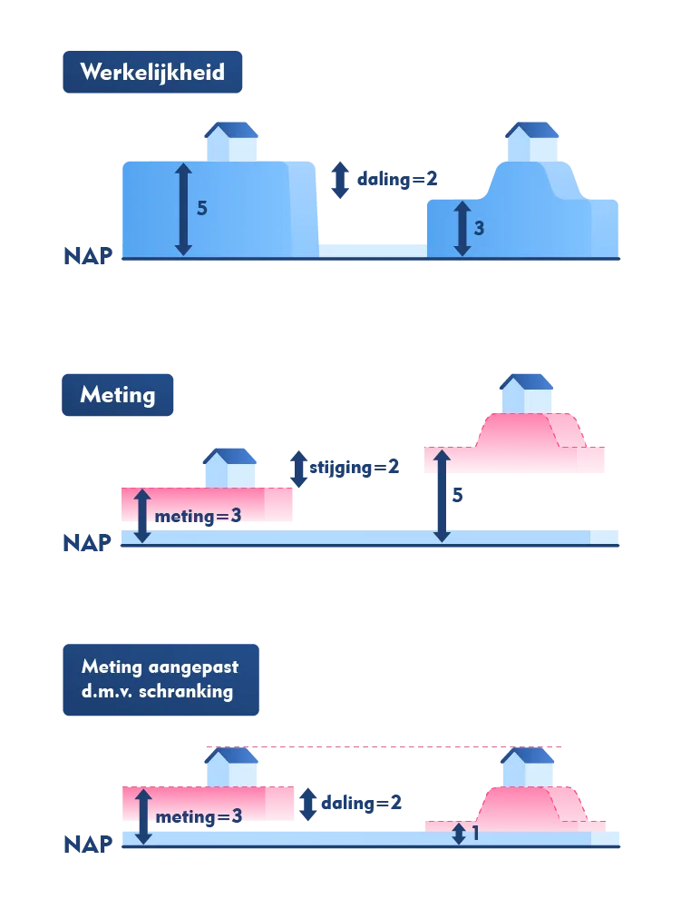
The concept behind schranking on gabled roofs
Results and benefits
- Improved accuracy: The newly computed height difference grid has a significantly narrower noise level than the grid computed with simple subtraction of two years.
- Shallow ground movements: The grid makes subtle changes in the surface layer visible.
- Reliable data: The approach eliminates measurement errors traditionally present in AHN comparisons where data sets are simply subtracted from each other.
Uses, applications and next steps
The development of this approach was made possible by the Waterschapshuis. It is currently being further developed by Geodelta to provide an even better description of ground motion. A derived version of the height difference grid is available on the Waterschapshuis website.