The new Delfy version 3.5.1 will be available soon. This update includes improvements to double-distance measurements, GNSS and Disto connections, feature codes, NTRIP casters, sketches and DXF reference data, as well as various bug fixes.
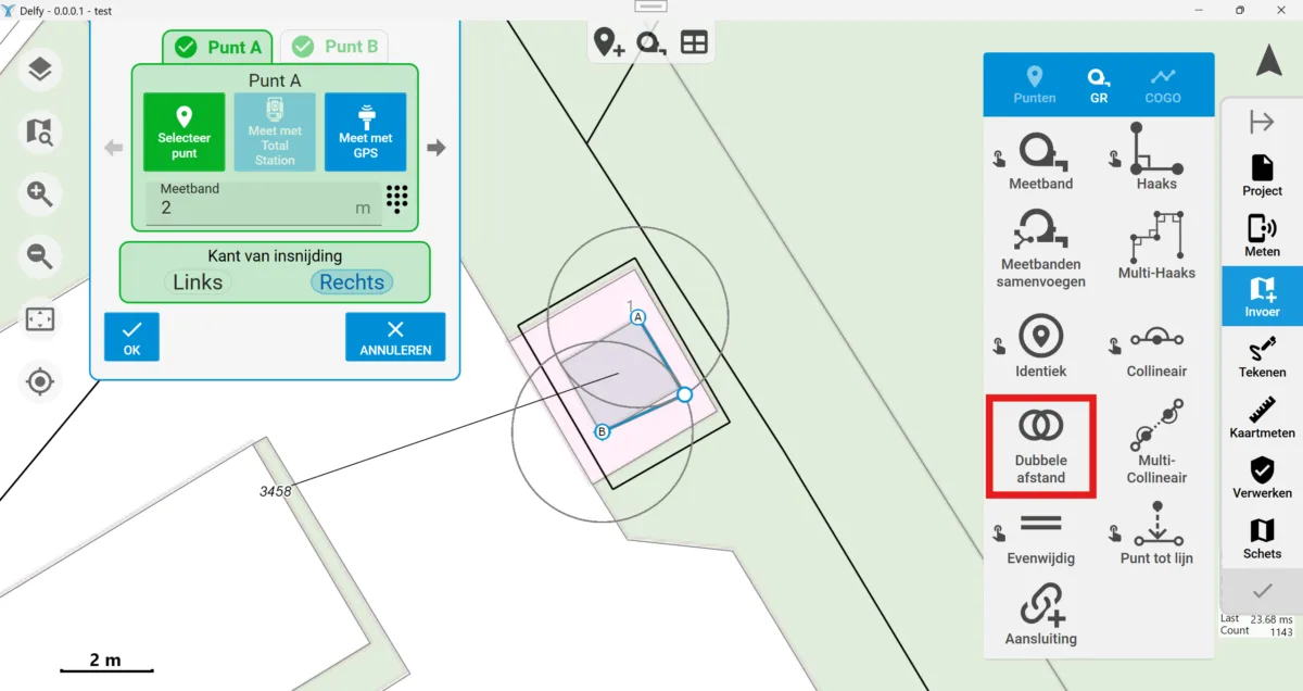
Double-distance measurements using total stations and existing points
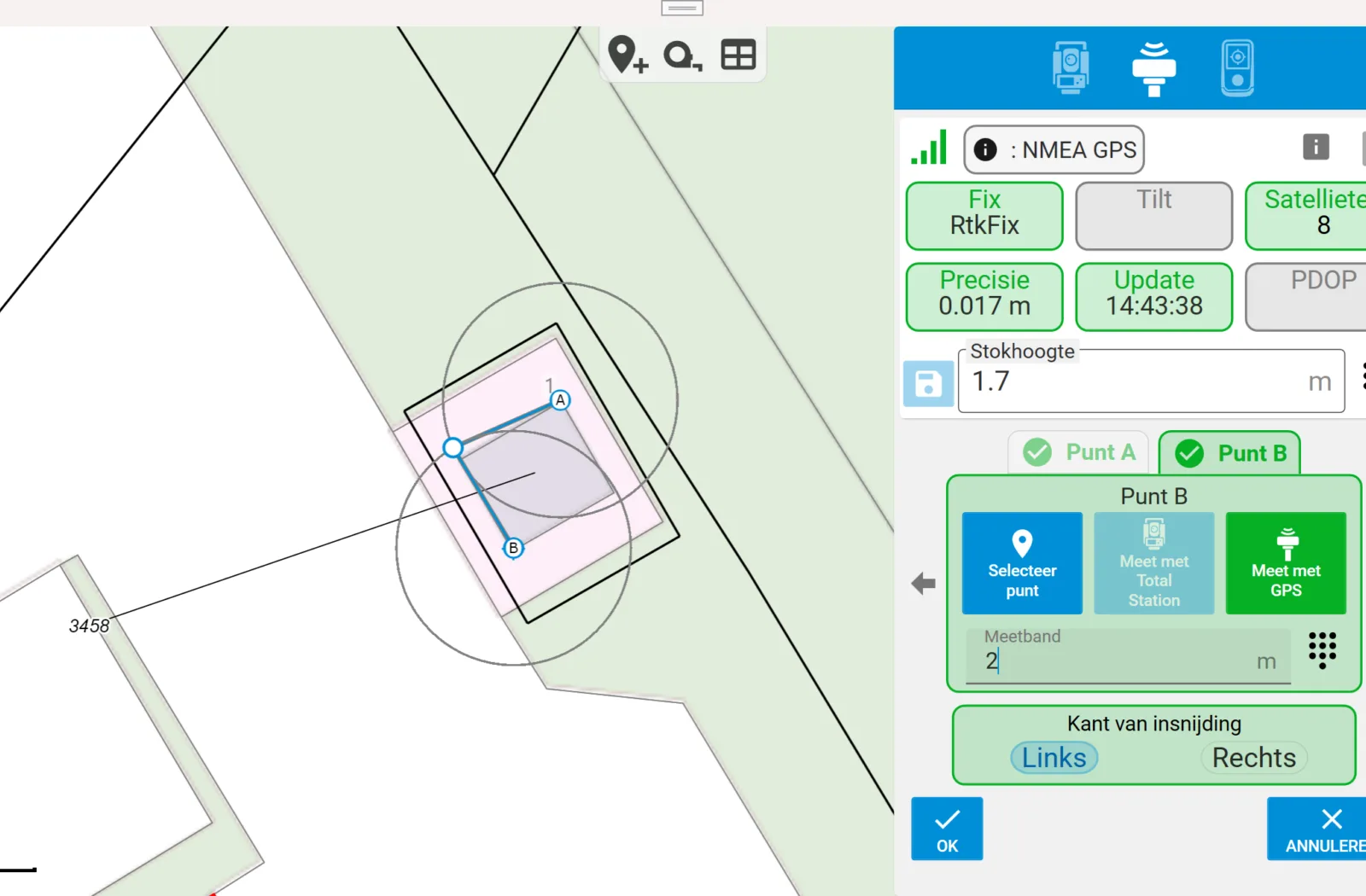
The Double-distance function is now available directly from the Input menu, in addition to its existing use in the GNSS measurement menu. When determining a point using double-distance measurements, you can now select existing points from the project or take total station measurements.
Select an existing point for point A and point B, or take a total station measurement, and enter the distance for each point. This also makes it easier to recreate double-distance measurements or use the function as a workaround when an earlier measurement was entered incorrectly.
Connecting Leica GNSS
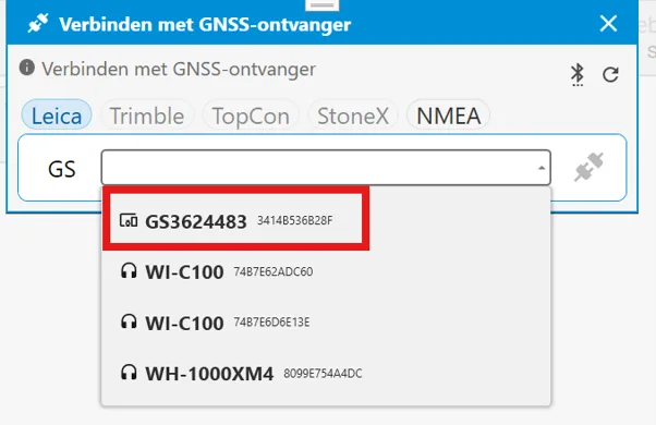
The connection to Leica GNSS has been updated. The connection is now established at instrument level. You need to select the correct instrument, for example GS#####, once.
Quick connect will not work the first time after this change. First connect the GNSS receiver manually, without using quick connect. After that, quick connect will work as expected again.
Additional functions for total station measurements
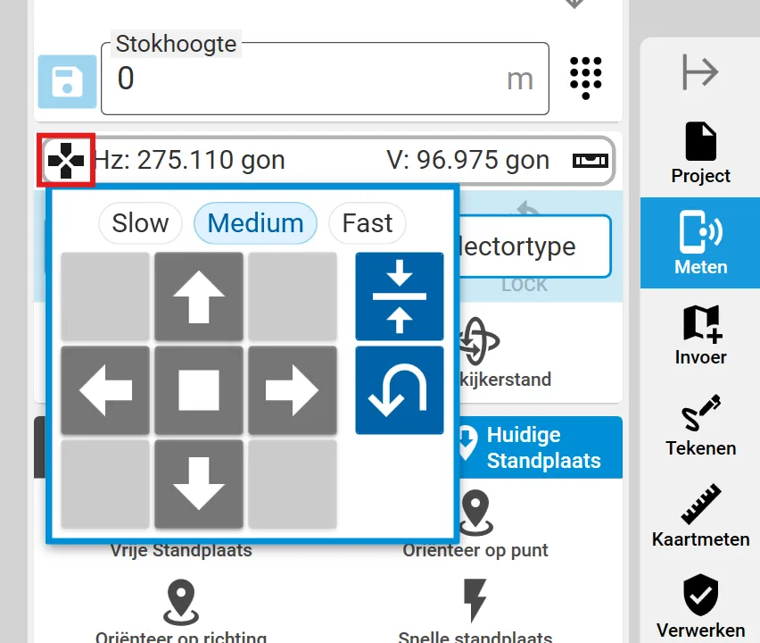
Two additional functions are available when measuring with a total station in Delfy. You will find them in the same toolbar as the horizontal and vertical angles.
The left button opens the joystick function. Hold down one of the arrow buttons to rotate the total station remotely in the selected direction. The movement stops as soon as you release the button. The two buttons on the sides can be used to orient the total station horizontally or rotate it directly through 180 degrees.
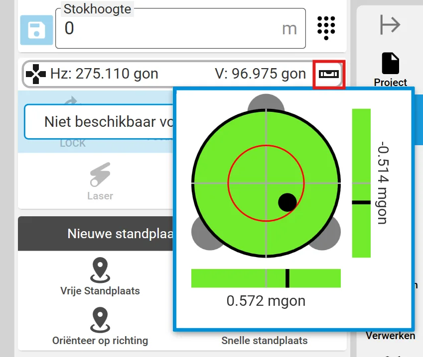
The right button opens the electronic bubble. This allows you to check remotely whether the total station is still level.
Selecting feature codes more quickly
Selecting feature codes has been improved. The window for adding a point now remembers and immediately displays the most recently used codes, allowing you to select frequently used codes more quickly.
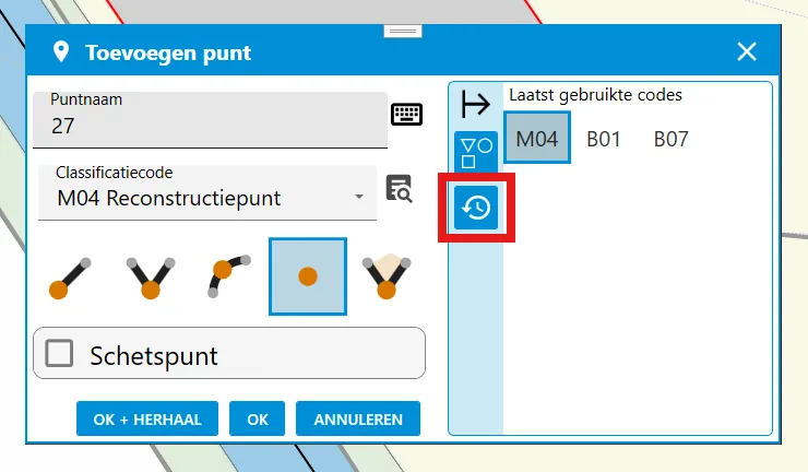
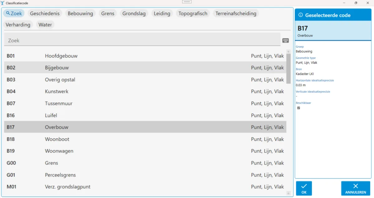
The button next to the feature code field also opens a search window. This window now searches the descriptions of feature codes as well.
Improved work list for objects
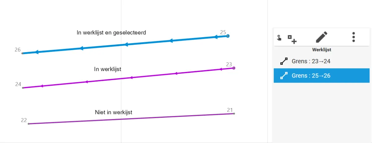
Working with objects in the work list is now clearer. An object’s context menu lets you zoom in, edit or delete the object, and control whether it is selected and included in the work list.
The same context menu is available from the work list and directly on the map. The distinction on the map is also clearer: objects in the work list are shown with arrows, while objects outside the work list are shown with a solid line.
Improved DXF reference data
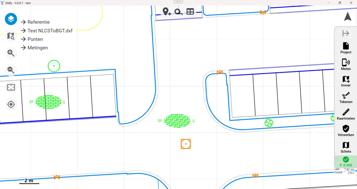
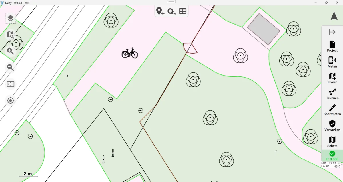
DXF reference data is now processed more effectively. Layers from a DXF reference file are also displayed as separate layers in Delfy. The display of inserts has also been improved.
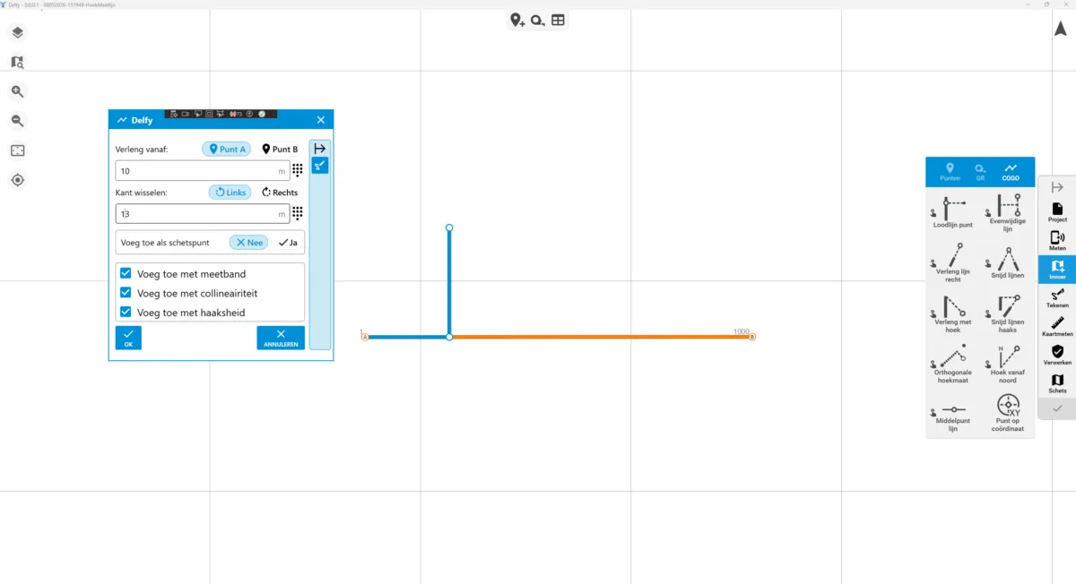
New COGO function for the orthogonal survey method
The version for the BES islands now supports the orthogonal survey method described in the Technical Handbook for Cadastral Work in the Netherlands (HTW). The function is available through Input > Orthogonal angle measurement (Invoer > Orthogonal hoekmaat).
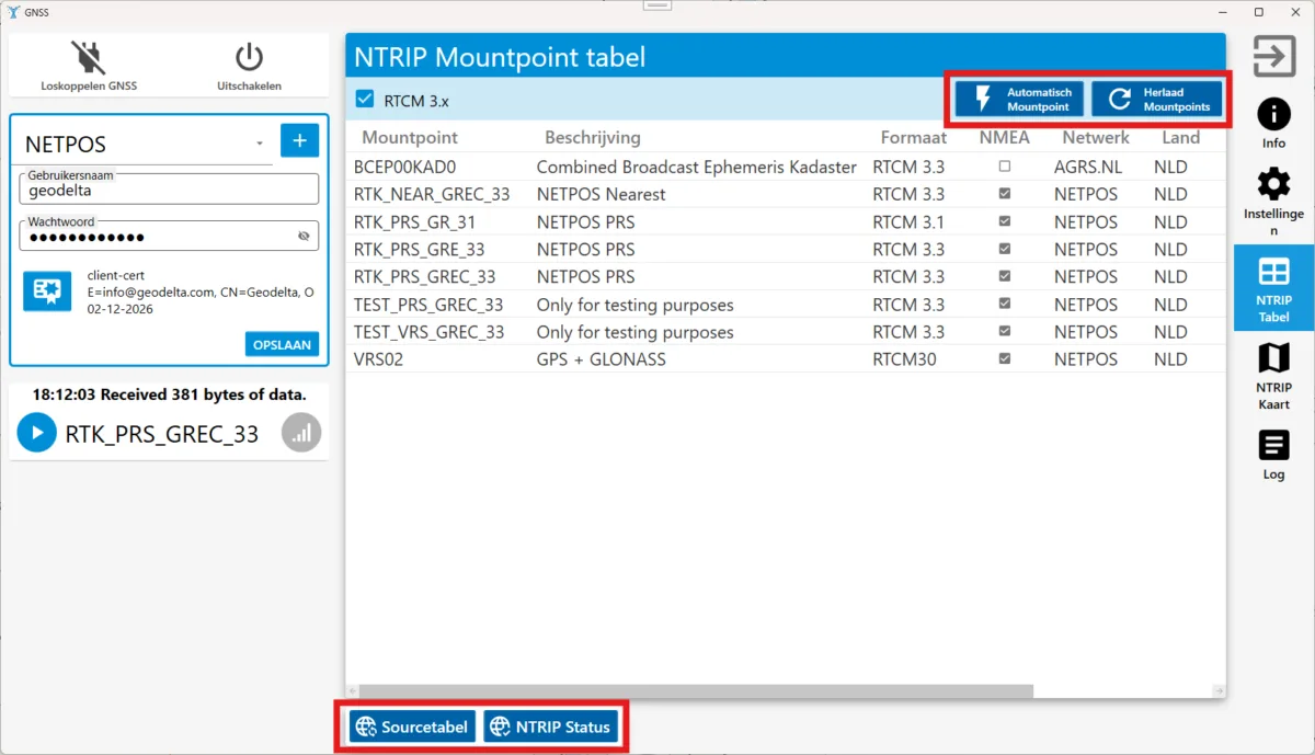
Setting up your own NTRIP casters
You can now add and manage your own NTRIP casters. When adding a new caster, its connection details are entered immediately so they can be reused later.
Various bug fixes, performance improvements and other updates
General:
- Cloud projects can now be saved as local copies.
- Users with administrator rights can delete projects in Delfy Cloud.
- A Kadaster test project type has been added for test projects that do not need to be uploaded to the cloud.
Measurements:
- Messages shown when measuring with shortcut buttons have been improved.
- Automatic reconnection to the Disto has been added.
- Advanced connection settings for total stations have been added.
- The offset of total station measurements can be adjusted afterwards.
- Offsets must now be entered in meters rather than centimeters.
- Taped distances that can be combined can now be detected automatically through GR > Combine taped distances (GR > Meetbanden samenvoegen).
- The F key is shown in the sidebar when possible.
- The wording of the “Reflector not found” message has been made less alarming.
- The instruction when setting out a line has been clarified from “Select point” to “Select line or 2 points”.
Sketch:
- When a point name is changed, Delfy automatically determines whether the point should be visible in the sketch.
- You can now add a sketch point in the sketch screen.
- You can now delete a selection of sketch points in the sketch screen.
- The sketch page name is automatically hidden during PDF export when there is only one sketch page.
- When dragging multiple objects, you can remove objects from the selection using CTRL + click.
- The “Verwijzing rood” (red reference) style has been added.
Tables:
- A button has been added to display the information in the GNSS table more concisely.
- Measurements, geometric relations, points and stations now have a visible identification number (ID) in the table.
- Empty table pages are no longer shown.
- Table performance has been improved.